Easy hikes near Mentone—without pretending every short trail is easy
Mileage lies on mountain terrain. Roots, rock, grade and wet footing matter more than whether a trail is one mile or three.
On this page
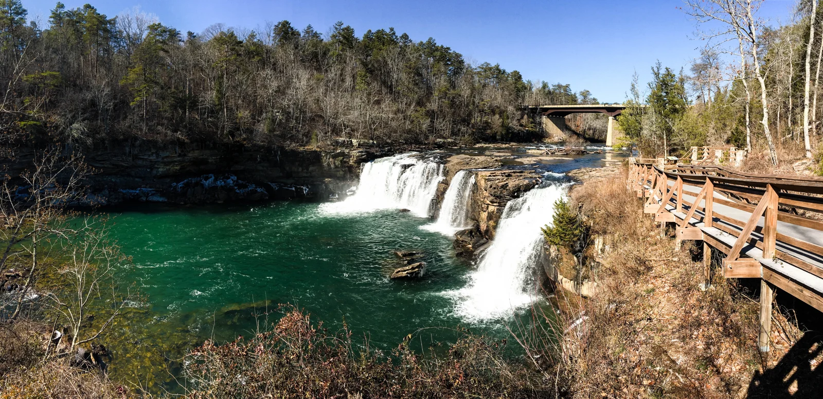
Little River Falls boardwalk
The 100-foot boardwalk is the most dependable easier-access nature stop in the region. NPS identifies accessible parking and an ADA route to the main waterfall overlook. A separate path with rock steps is shorter but not the accessible option. This is the right first choice for mixed mobility, limited time or uncertain weather.
DeSoto’s boardwalk—not the whole trail system
DeSoto State Park lists an ADA-accessible boardwalk, but the park is explicit that its natural trails include roots, rocks and mountain terrain. Treat the boardwalk as its own experience. Do not let the word “short” talk the group into a waterfall route that requires uncomfortable footing.
Beaver Pond Trail and overlook walks
NPS describes Beaver Pond Trail as an easier wooded walk of less than two miles. Along the Rim Parkway, several overlooks require only brief walks from parking, but surfaces and grades vary. If the goal is scenery rather than exercise, selected overlooks are often the smarter answer.
What to ask before starting
- Is the return uphill?
- Are there steps, roots or wet rock?
- Can the least-mobile person turn around comfortably?
- Does the payoff still exist during a dry spell?
Choose the return before the destination
Start with the person who has the least walking margin. A trail that descends first can hide its hardest work until the return. Establish whether the route is a loop or out-and-back, where steps begin and whether everyone can turn around before that point.
| Choice | Good reason to choose it | What it does not promise |
|---|---|---|
| Little River Falls boardwalk | A developed route to a major view | Access to the river or Little Falls |
| Talmadge Butler Boardwalk | A forest outing without committing to natural trail terrain | Strong cascade flow during a dry period |
| Beaver Pond or a natural park walk | You want the woodland experience itself | A step-free or obstacle-free route |
| Established overlook path | A short scenic pause | Every overlook has the same surface or grade |
A realistic walking plan
Begin with a shorter choice, carry water and leave time for the return. If the first part is slower than expected, shorten the destination rather than compressing the return. Use a park map and follow marked routes; a shortcut drawn by an app can erase the very terrain information that made the outing suitable.
Check specific access requirements separately and use the waterfall comparison when a waterfall, rather than a walk, is the goal.